Free · No sign-up · Try Pro free for 14 days
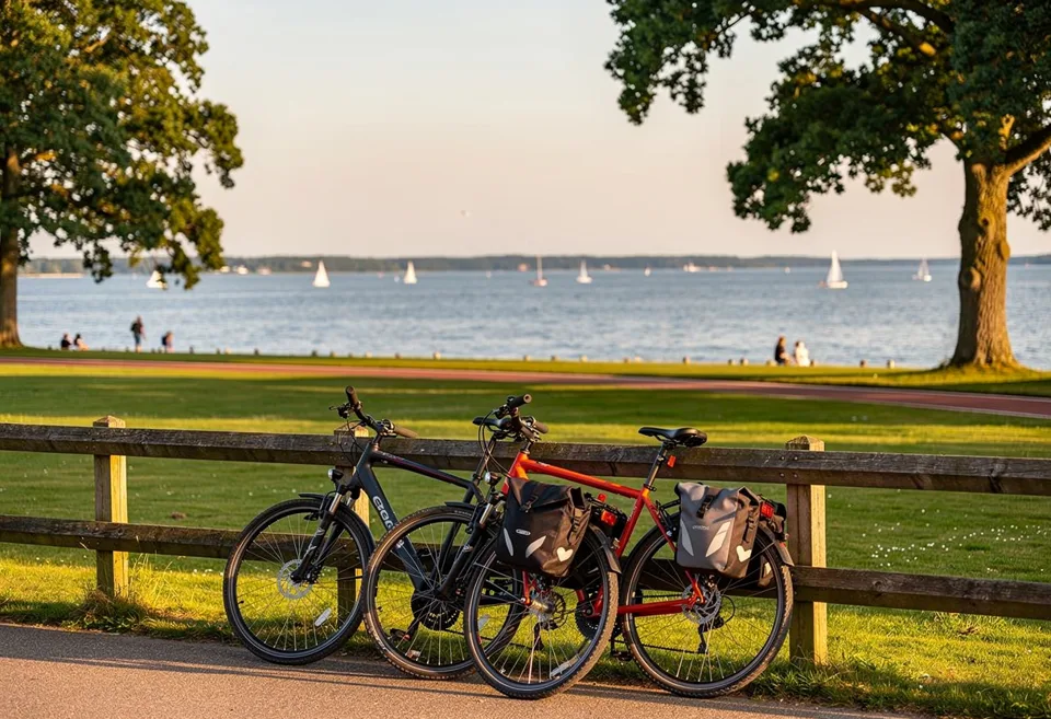
Feierabendtour auf dem Rad im warmen Abendlicht
Version 5.0 · Cycling · Running · Hiking

Your rides. Rethought.

Biketour.Guide navigates by voice — and makes more of it: challenges and leagues with others, curated routes across Europe and your CO₂ balance for every kilometre. Starts without sign-up.

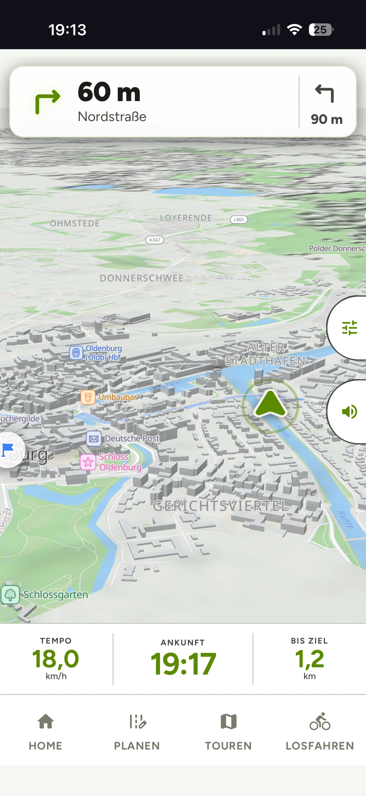
Tagesnavigation in der App: Abbiegen in 50 m auf die Uferstraße, Routing-Profil MTB, Ankunft 14:27
3 sports
Cycling · Running · Hiking
48
badges to collect
Teams of 8
Leagues & challenges — free
0 €
Navigation & tracking — for good
What makes Biketour.Guide different

Three reasons to start today.

Community

Challenges, leagues & teams

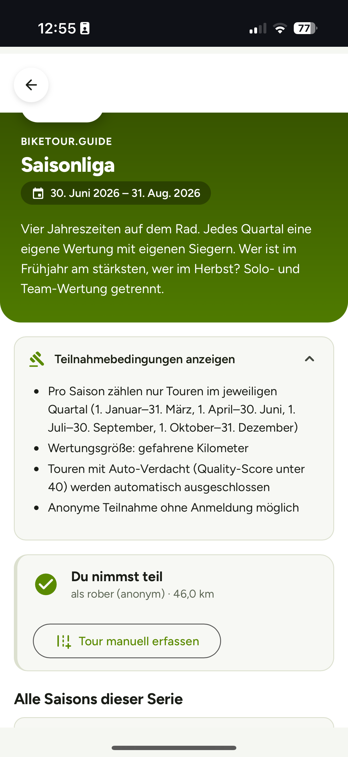
Season league, commuter league, weekly cup — teams of up to 8, scored by regional profile. Taking part is always free.

Your balance

CO₂ and money, honestly calculated

Every ride is measured against your car: CO₂ avoided, fuel costs saved, calories burned — the statistical depth behind it is Pro.

Routes

Curated routes across Europe

Verified data, unambiguous routing, real highlights — quality over quantity, from an after-work spin to a bikepacking weekend.

And of course: voice navigation · weather along the route · GPS tracking with distance, pace and calories

How it works

Plan. Ride. Keep going.

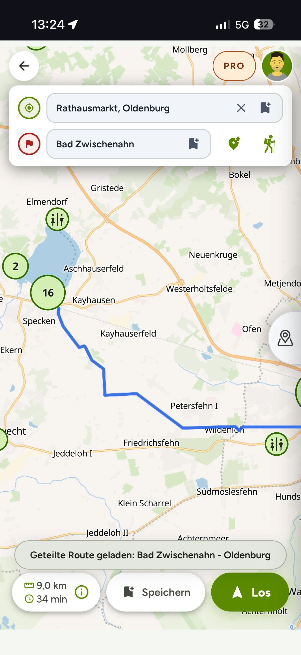
App-Startbildschirm: Route planen oder einfach losfahren
01 Plan

Build a route — on your phone or on the big screen in the web app. Pick your own profile or take a ready-made route from the catalogue.

Sprachnavigation bei Nacht: Abbiegehinweis in 170 m, Info-Ansage zur Weiterfahrt
02 Ride

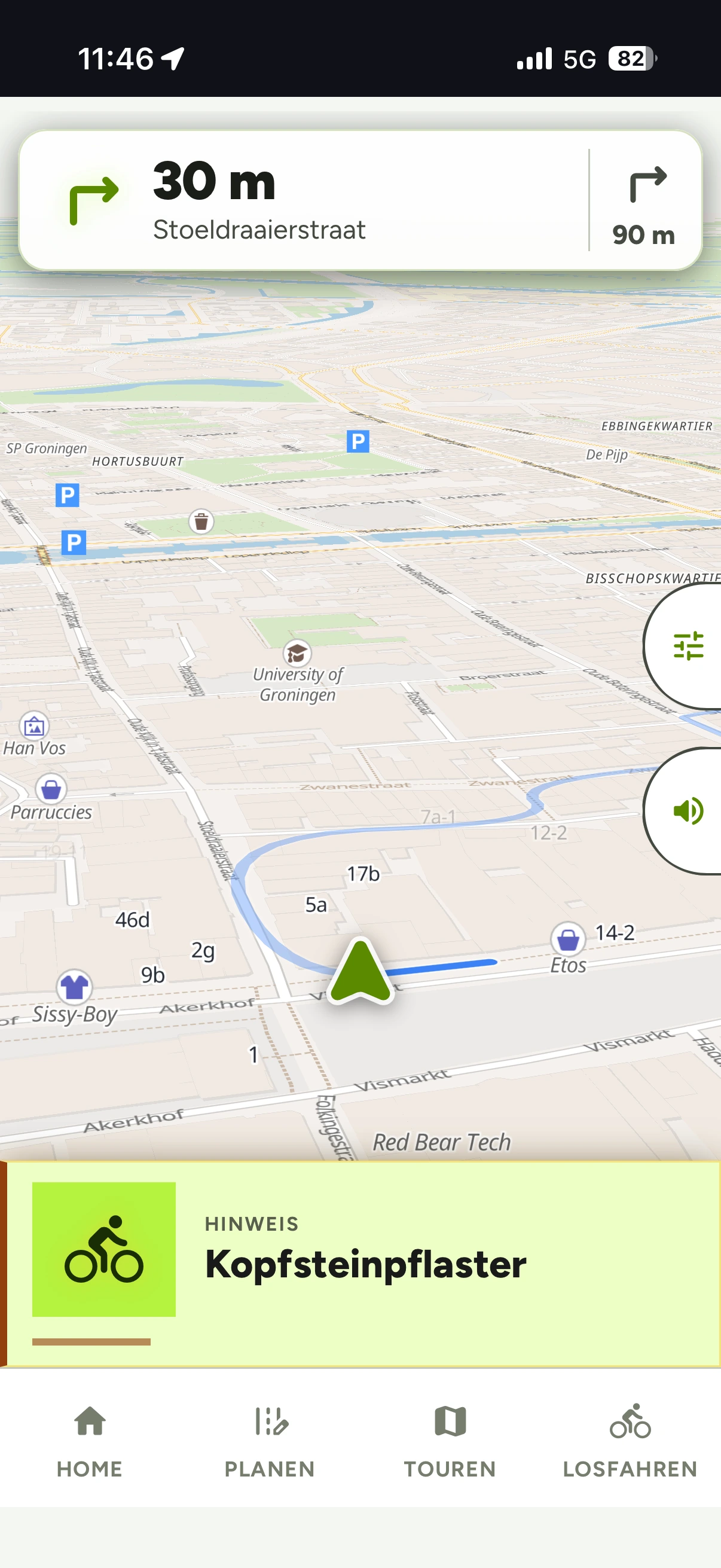
Voice navigation guides you — at night too. The app warns you about hazards, cobblestones and climbs before you are in them.

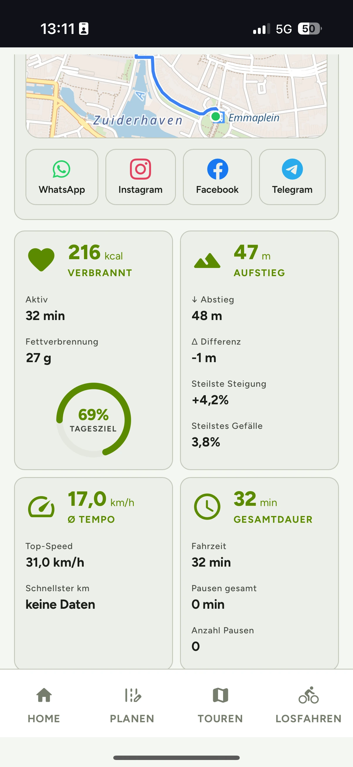
Meine Routen in der App: gefahrene Touren mit Karte, Distanz und Aufstieg
03 Keep going

Every ride counts: statistics, season league, commuter league, weekly cup — and 48 badges to collect.

The app

Know what's ahead.

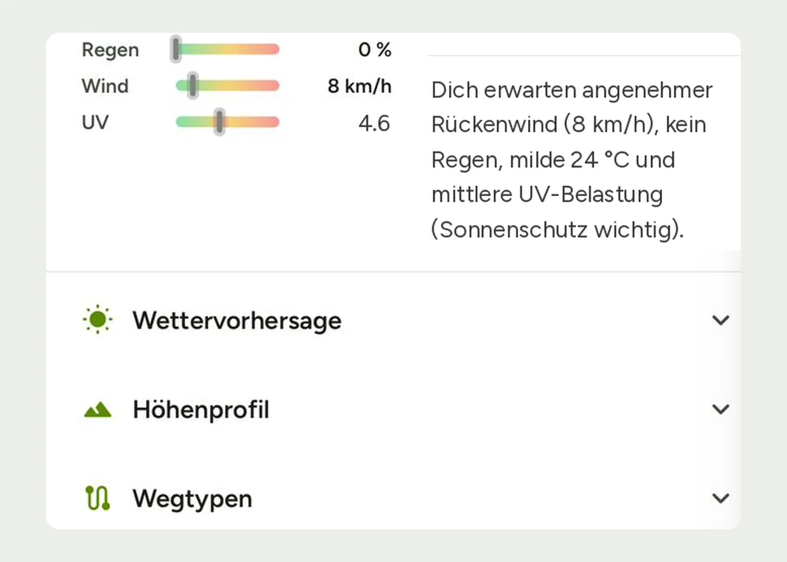
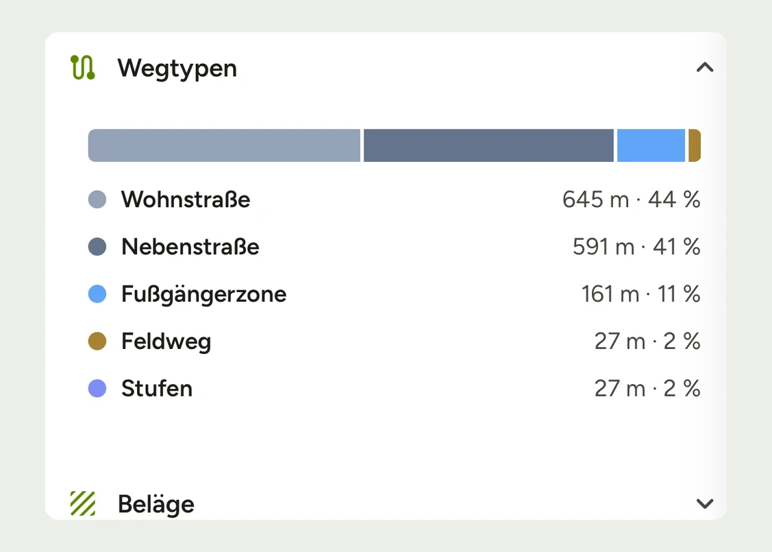
Wetter direkt auf der Route: Regen, Wind und UV mit Hinweis, dazu Wegtypen- und Belag-Aufschlüsselung

Weather along the route. Rain, wind, UV — for your route, not for the town next door.

Touren und Orte in der Nähe: Vorschläge mit Entfernung

Routes nearby. The catalogue knows routes across Europe — including where you are right now.

Your balance

Every ride pays off.

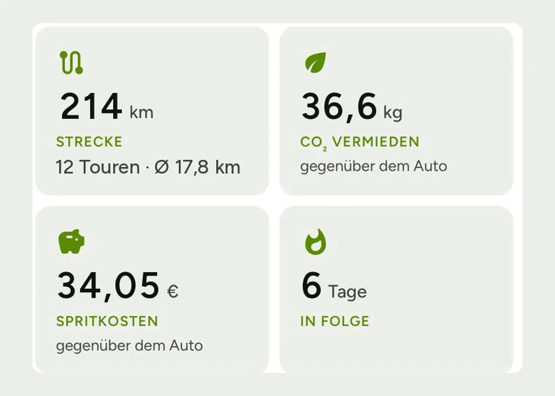
The app measures every ride honestly against your car: CO₂ avoided, fuel costs saved, calories burned — with your figures, not with averages. And one tap shares the result.

3.4 kg
CO₂ avoided
€2.53
fuel costs saved
574 kcal
burned
CO₂ and money statistics are Pro →
Community

Never ride alone again.

Season league, commuter league, weekly cup: the autumn round 2026 starts on 7 September — 8 weeks, teams of up to 8, scored by regional profile. And one tap shares every finished ride with your group: WhatsApp, Instagram, Facebook, Telegram.

“The commuter league turned my ride to work into a competition. 340 km in October — team best.”

Meike · Team Ammerland · from the beta

“Ride finished, one tap — and the result is in the family chat. That's all I need.”

Jörg · Bremen · from the beta
See challenges & leagues →
48 badges to collect — for distance, climbing and streaks
First ride
50 rides
500 km
5,000 km
25,000 m climb
HC climb
7-day streak
Active month
Getting started

Phone only → + sensors → + Pro

01 Phone only

GPS tracking, navigation, routes, challenges & leagues — ready to go, without sign-up.

02 + sensors & data

More data, fuller picture: the app records distance, pace, calories and elevation — and turns every ride into an honest balance.

03 + Pro

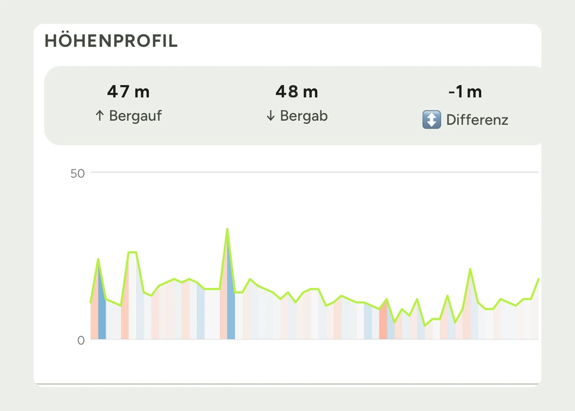
The analysis layer: weather, way types, elevation profile and hazard warnings — explained in plain words, before the start and after the ride.

Pro

Understand your ride.

Weather, surfaces, elevation – Pro turns data into clear answers. Before the start and after the ride.

Jahr−44 %
39,99 €
= 3,33 €/Monat
Monat
5,99 €
monatlich
14 Tage gratis, danach 39,99 €/Jahr
Free vs. Pro in detail →
Pro unlocks
  • Custom routing – your own profiles
  • Weather, way type & elevation analysis
  • Hazard & surface warnings
  • Voice navigation
  • Offline maps (Germany)
  • GPX export
  • CO₂ and money savings statistics
  • Leaderboards & personal goals
Pro explained

Explained, not just measured.

Every figure in the app is tappable — and explains itself in plain words. Four examples:

Wind

Shows wind direction and strength along the route. Headwind costs energy – knowing it lets you plan the direction more wisely.

Surface

Shows what your route is made of: asphalt, gravel or cobblestones, for example. Important for tyre choice and pace.

Elevation gain

The sum of all climbs on your route – descents do not count against it. The more elevation gain, the harder the ride.

Money saved

Shows roughly what the same distance would have cost you by car.

Offline maps

Map on board — even without a signal.

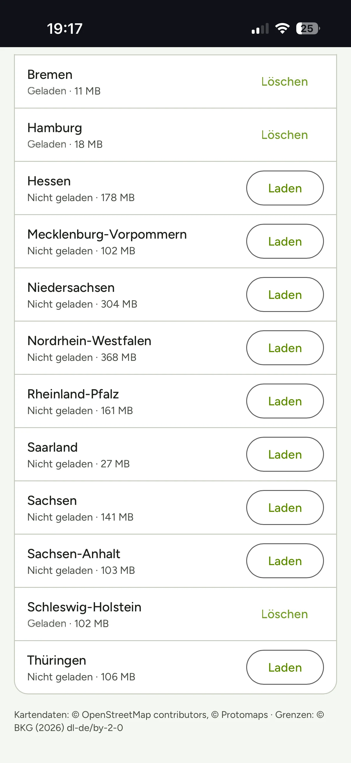
Offline maps (Germany): download the states you need — and your map is there, even when there is no reception left.

Offline maps for Germany are part of Pro →
Offline-Karten in der App: Liste der Bundesländer mit Download je Land
Privacy

Start without signing up. An account only when you need one.

No sign-up is not a marketing line, it is architecture: you plan, navigate and track right away — you only need an account if you want to sync across devices. This website uses cookies for statistics and embedded services; in the cookie banner you decide what runs, and you can change it at any time. What is stored is set out in the privacy policy.

Radweg durch die Dünen
Start riding

Your next tour starts here.

Get Biketour.Guide on your phone — start without signing up.

Free to download — you will be riding within a minute.
Plan in the web app → on the big screen
QR-Code: biketour.guide/app
Scan the code with your phone — it takes you to the right store.